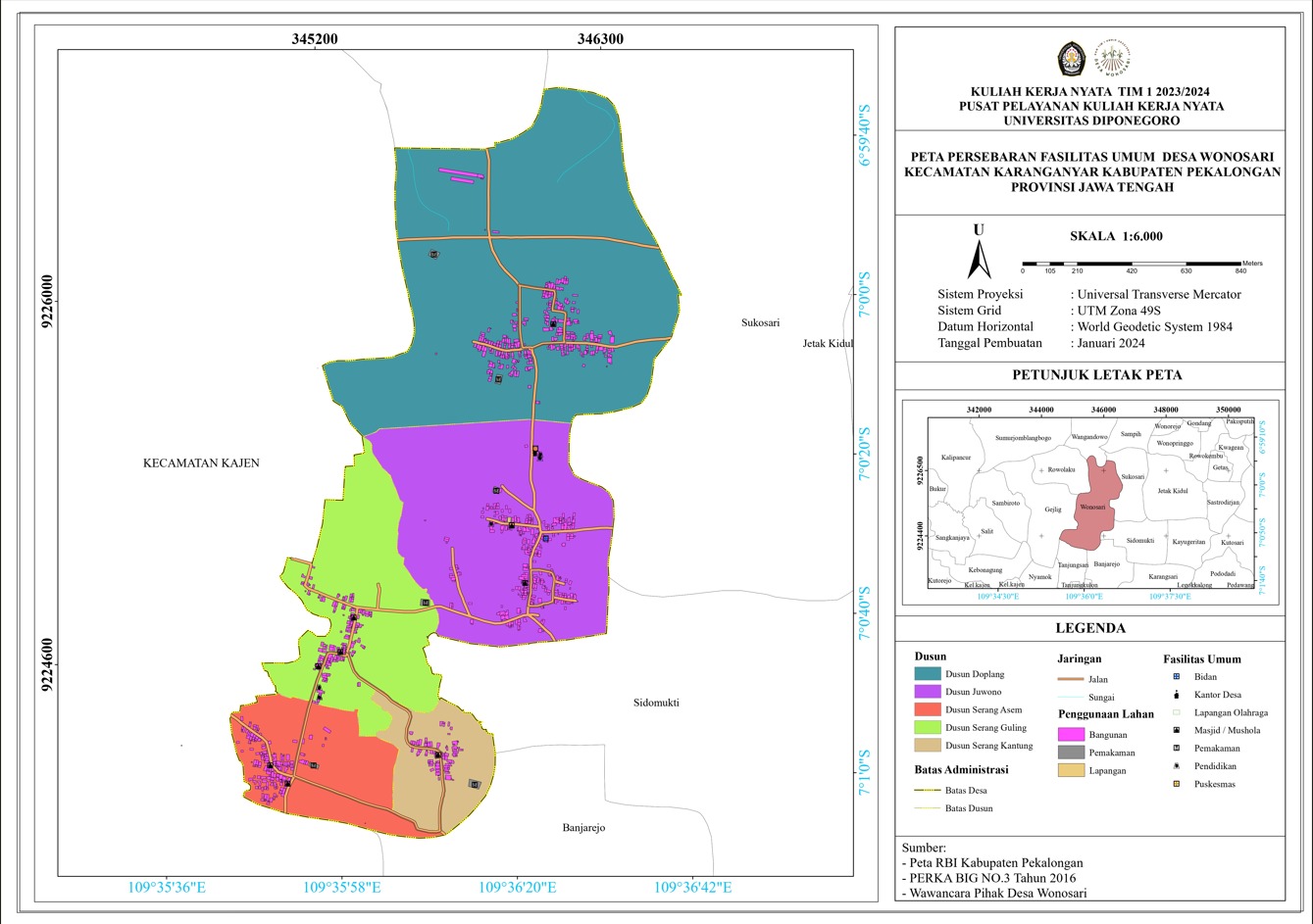
Public facilities are the facilities that the community can utilize publicly. To illustrate the public facility location in Wonosari Village, Karanganyar District, Pekalongan Regency, Garin Aprilino Matondang, a student of Geodesy Engineering at Diponegoro University, made a map of the distribution of public facilities in Wonosari Village. On Monday (5/02), Community Service (KKN) students submitted the public facilities distribution map.
The process of creating a map for Wonosari Village began with field surveys that took place over several days. The students then used the Avenza Maps application to map the coordinates of public facilities around the village and gathered data by interviewing local village officials. Later, they processed the data and consulted with village officials to ensure the accuracy and relevancy of the information on the map.
The map-making process took about a week, and consultation with village officials was a crucial step in aligning the collected information with local policies and needs. The map is not just a collection of symbols and lines; instead, it reflects the daily life of the Wonosari Village community.
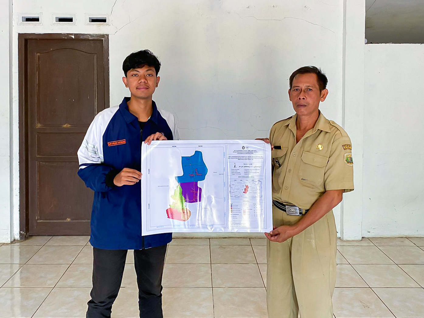
Once the map was available in print, the KKN students handed it over to village officials along with an explanation of how to read the map and its functions. The “Creation of a Map of the Distribution of Public Facilities in Wonosari Village” program goes beyond a typical map printout. The aim is for this map to serve as a guide for the Wonosari Village community, helping them navigate important centers such as health facilities, schools, and other public amenities accurately. With this map, it is hoped that both residents and newcomers will feel more comfortable when looking for public facilities.
Author: Garin Aprilino Matondang (Geodesy Engineering – Faculty of Engineering)